 vesseltracker.com
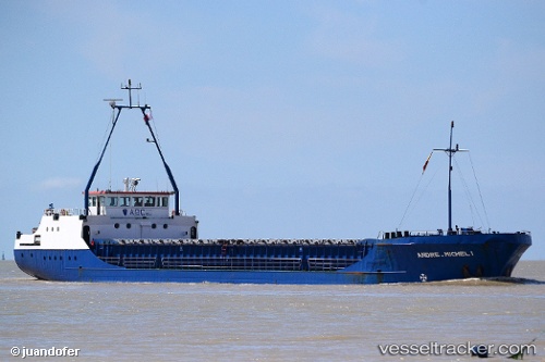
Vessel BMO RIVER IMO: 8511914, MMSI: 511100682 General Cargo
UTC, 44.45333, 12.26167, course: -1, speed: 0
UTC, 44.45343, 12.26293, course: 124, speed: 0
2026-02-06 09:30:23 UTC, 44.45339, 12.26296, course: 123, speed: 0
Live AIS position:
UTC. Near Marina di Ravenna),
updated 2026-02-06 09:30:23 UTC.
Find the position of the vessel BMO RIVER on the map. The latter are known coordinates and path.
marine traffic ship tracker show on live map
The current position of vessel BMO RIVER is 44.45339 lat / 12.26296 lng. Updated: 2026-02-06 09:30:23 UTCCurrently sailing under the flag of Palau
BMO RIVER built in 1986 year
Deadweight:
1613 tDetails:
Last coordinates of the vessel:
UTC, 44.45333, 12.26167, course: -1, speed: 0UTC, 44.45333, 12.26167, course: -1, speed: 0
UTC, 44.45343, 12.26293, course: 124, speed: 0
2026-02-06 09:30:23 UTC, 44.45339, 12.26296, course: 123, speed: 0